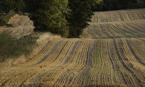
The stubble left from harvesting Fields of Oats and Barley at Haregill Lodge Farm, Ellingstring, North Yorkshire - Paul Harris/2020VISION
Information on HabiMap for Landholders, Farmers, and Land Managers
Working with wildlife for mutual benefits
Nature is facing a critical decline, and your support is essential in reversing this trend in Gloucestershire. Our commitment is to map all non-urban land in the county through detailed botanical surveys, identifying key opportunities to halt wildlife loss. By granting us limited access to your land, we can highlight specific areas where environmental enhancements can protect nature and offer tangible benefits for you as a landholder. Together, we can make a meaningful impact on both local ecosystems and your land’s value.
Key Points
We are seeking land access permissions to allow our trained volunteer surveyors to conduct habitat surveys on your property.
From the HabiMap Programme, you will get:
Detailed free of charge habitat survey
Complimentary report with habitat maps
Opportunity to discuss further survey needs and advice
Increased knowledge of the wildlife in your land
Our focus is on botanical ID as we aim to gather valuable data for updating Gloucestershire’s Nature Recovery Network and Ecosystem Service maps. The information collected will help support informed decisions about land management investments, ultimately helping to enhance nature and the ecosystem services it provides and foster environmental recovery.
Who can get involved?
We’re seeking participation from landholders of:
Since we only survey land where the landholder (owner, lessee, or tenant) has granted permission, your participation is crucial for accurately mapping Gloucestershire!
How it works
Once you complete the permissions form, our surveyors will be ready to begin. During the survey season (April to September), a lead surveyor will select your land and contact you to arrange the visit. You are not required to be onsite during the survey, but you are welcome to join if you wish.
On the scheduled day, the lead surveyor, often accompanied by other trained mappers, will walk the site to assess the topography and survey each habitat according to UK Hab standards. The data will be recorded using a specialised surveying app and then uploaded to GWT for processing.
After analysing the data (from October to February), we will provide you with a detailed PDF report outlining our findings.
Benefits
By allowing us access to survey, you will receive a report with accurate and up-to-date habitat data that could benefit you in several ways:
- Helping you access agri-environment funding, such as future Environmental Land Management payments for public goods, which are based on maintaining or increasing ecosystem services.
- Identifying opportunities to access multiple funding sources for delivering different ecosystem services on your land.
- Creating opportunities to participate in funded environmental projects, such as delivering biodiversity net gain for developers.
- Helping you access Biodiversity Net Gain opportunities
- Increasing your knowledge of the wildlife on your land.
It’s important to note that our habitat surveys do not affect your control over your land or potential future development, as these are regulated through the planning system.
Click for more detailed information, including FAQs
Other information!
Click the links below to find out background details on the project and volunteering opportunities.

